|
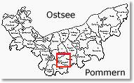
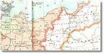
map showing the area around Stargard in Pom. with the locations where Rollenhagen's lived in the last century |
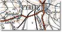
map of the area of Kreis Saatzig, Regierungsbezirk Stettin, Pommern in greyscale (259k) or coloured (244k)
|
|
|
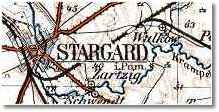
map of the area of Kreis Greifenhagen
(before 1939), Regierungsbezirk Stettin, Pommern; coloured (223k) |
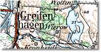
| map of the area of Kreis Pyritz, Regierungsbezirk
Stettin, Pommern; coloured (198k) |
|
|
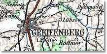
map of the area of the Kreis
Greifenberg, Regierungsbezirk Stettin, Pommern; colored (182k)
other counties will follow |
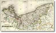
| map of the Provinz Pommern
from the year 1845 (432k). You also can watch them larger, but in a left and a right part |
|
|
the area of Pomerania in the
year 1648 (state and administration borders)
Pommern im Jahre 1648 (Staats- und
Verwaltungs- grenzen) |
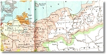
the area of Pomerania in the
year 1789 (state and administration borders)
Pommern im Jahre 1789 (Staats- und
Verwaltungs- grenzen) |
|
|
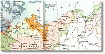
the area of Pomerania in the
year 1815-1866 (state and administration borders)
Pommern im Jahre 1815-1866 (Staats- und
Verwaltungs- grenzen) |
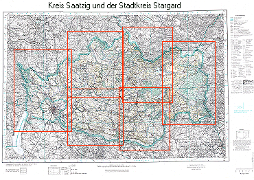
Der Kreis Saatzig im Jahre 1939 (detaillierte Karte), unterteilt in 6
Abschnitte. Achtung: Um die Qualität und Lesbarkeit zu erhalten, sind
die einzelnen Abschnitte ziemlich groß gewählt und zudem in relativ hoher Qualität
abgespeichert, was leider zu Lasten der Downloadzeit geht (410-670 kb)
The county of Saatzig in the year 1939 (detailed map),
seperated in 6 parts. Please note: In order to keep the quality and
keeping it readable the parts are pretty big and saved in high quality, unfortunately on
expense of the download time (410-670 kb) |